Turn Your Property & Parcel
Into a Professional 4K Drone Video.
Discover Your Property From Above.
Enter your TKGM parcel information — SanalDrone uses AI-powered location analysis to create a cinematic virtual aerial presentation of your property. No pilot, no flight permit, no equipment. Just precise parcel data transformed into a professional 4K property video — up to 90% more economical than traditional drone production.


 Credit Card
Parcel Lookup, TKGM Parcel Query and Free Virtual Drone Video Technology
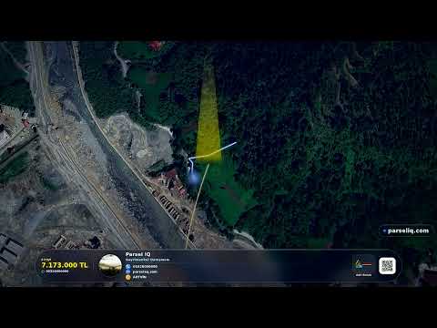
ParselIQ is a platform that creates professional, drone-perspective real estate promo videos using AI and satellite imagery, without any real drone flight (this type of content is sometimes called "virtual drone video" in the industry). ParselIQ combines the TKGM (Turkish Land Registry and Cadastre) database with GIS data to generate an AI drone video for any block/parcel number across all 81 provinces of Turkey.
A traditional real estate drone video shoot requires a pilot license, drone flight permit, airspace approval, and costs ₺3,000–₺8,000, while ParselIQ delivers a 90-second, 4K-quality MP4 video within 15 minutes. The generated videos can be used on all of Turkey's leading real estate portals, such as Sahibinden, Zingat, Hürriyet Emlak, and Emlakjet.
Fly a Virtual Drone Over Your Land — AI Drone Video
A virtual drone video is a way to generate a drone-flight-style video over land or a parcel using AI, without flying a real drone. With ParselIQ, you can start a virtual drone flight over your land in seconds just by entering the block/parcel number, and try your first free virtual drone video at no cost.
How to Do a TKGM Parcel Query
Information Needed for a Parcel Query
For block/parcel lookup and parcel viewing, simply enter the province, district, block, and parcel number. The platform automatically pulls the parcel boundaries, coordinates, and property details from TKGM. All property types are supported — land, fields, houses, apartments, villas, commercial, and industrial.
What You See in the Parcel Query Result
ParselIQ provides AI-powered real estate video generation services in Istanbul, Ankara, İzmir, Antalya, Bursa, and all other provinces of Turkey.
Supported Property Types
Parcel lookup and AI drone video are supported for land, fields, houses, apartments, villas, commercial, and industrial properties.
How to Do a Parcel Query, Step by Step
A parcel lookup is the process of viewing a property's boundaries, coordinates, and basic details using its province, district, block, and parcel number via TKGM (Turkish Land Registry and Cadastre) data. The process is completely free and takes 2 minutes.
Step 1 — Select Province and District
Narrow down the query by selecting the province and district/neighborhood where the property is located. TKGM cadastre data is available in all 81 provinces of Turkey.
Step 2 — Enter the Block and Parcel Number
Simply enter the block/parcel number shown on your title deed or in e-Devlet into the relevant fields. If you don't know the number, you can also find it by clicking the property on the map.
Step 3 — View the Result
The query result shows the parcel boundaries, area, coordinates, and property type (land, field, residential, commercial, etc.). This information is completely free.
What Can You Do After the Parcel Query?
Once you know your parcel number, you can enter it into the search box above to try a free virtual drone video of your land or property — no physical drone, pilot, or permit needed, and you get a 4K-quality video in 15 minutes.
Frequently Asked Questions About Parcel Queries
Is a parcel query free?
Yes. A TKGM-based block/parcel query is completely free — you don't need to pay anything.
Where do I find the block/parcel number?
You can find it on the title deed, in your e-Devlet land registry records, or by clicking the property on the parcel query map.
Parcel Lookup to Drone Video in 3 Steps
No need to rent a physical drone, get permits, or hire a pilot. All you need is the property's block/parcel number.
Look Up Your Parcel
Select province, district, and neighborhood — enter the block and parcel number. TKGM & GIS data is matched automatically.
AI Generates the Video
AI generates the frames, and the render.parseliq.com cloud server converts them to MP4. H.264 codec, high quality, professional output.
Download & Add to Listing
Download as a 4K-quality MP4. Upload it directly to platforms like Sahibinden, Hürriyet Emlak, Zingat, or to social media.
The Real Estate Agent's Sharpest Tool
While your competitors are still working with photos, offer a professional drone video with AI + Server Render.
AI + Server Render
Enter the block/parcel number, AI generates the frames, and the render.parseliq.com cloud server produces a professional MP4 export.
AI Agent BETA
Just describe it in one sentence: "Prepare a luxury video for an 850 m² sea-view plot in Urla, İzmir." AI sets the location, block/parcel, camera effects, music, and voiceover for you.
Bulk Lookup NEW
List dozens of parcels at once and queue them all for automatic rendering. No need to handle them one by one — one list, one click.
4K MP4 Output
A 4K MP4 video is generated within seconds. H.264 codec, high quality, small file size.
Satellite Imagery Compositing
Up-to-date satellite photos are combined with a 3D terrain model to create a realistic drone-view perspective.
Nationwide Coverage
All 81 provinces, districts, and neighborhoods are supported. Land, fields, residential, commercial — every property type.
Cloud Render Technology
Runs server-side with Puppeteer + FFmpeg on the render.parseliq.com infrastructure. Browser-independent, powerful, and fast.
API Integration
Integrate with your own system or real estate portal via REST API. Bulk generation is supported.
How Does ParselIQ AI + Server Render Work?
Uses Claude, GPT-4o, and Gemini for AI frame generation. It then converts to MP4 on the render.parseliq.com cloud server. Browser-independent, fast, and secure.
Real Drone vs ParselIQ AI
Compare physical drone shoots with AI + Server Render-powered professional video generation.
| Feature | 🚁 Real Drone | 🤖 ParselIQ AI |
|---|---|---|
| 💸Cost (per video) | ✗ ₺3,000 – ₺8,000 | ✓ Starts at just a few ₺ |
| ⏱️Delivery Time | ✗ 3–7 business days | ✓ ~15 minutes |
| 📋Permits & Bureaucracy | ✗ Required (drone permit, etc.) | ✓ Not needed |
| 🌦️Weather Dependency | ✗ Yes (risk of flight cancellation) | ✓ None whatsoever |
| 🗺️Nationwide Coverage | ✗ Limited to pilot's region | ✓ 81 provinces — full support |
| 📐Parcel Boundary Display | ✗ Manual, approximate | ✓ Automatic (TKGM database) |
| 🎬Video Quality | ✗ 4K (conditions permitting) | ✓ 4K guaranteed |
| 🔄Regeneration | ✗ Cost + time again | ✓ One click, instant |
| 🤖AI Analysis | ✗ None | ✓ Automatic parcel & SEO text |
| 🌐API Integration | ✗ None | ✓ REST API + bulk generation |
| Result | Expensive · Slow · Risky |
Save up to 95%
🏆 The Agent's Choice
|
Pay As You Go
No monthly subscription. Buy tokens, use them whenever you want.
Current rate: 1 USD = ₺49.18 · 1 EUR = ₺55.42

- 150 AI Token (≈6 videos)
- Video generation & voiceover
- Parcel map & AI analysis
- 4K MP4 export
- 24/7 priority support

- 700 AI Token (≈28 videos)
- Video generation & voiceover
- Parcel map & AI analysis
- 4K MP4 export
- Bulk generation mode
- 24/7 priority support

- 2,100 AI Token (≈84 videos)
- Video generation & voiceover
- Parcel map & AI analysis
- 4K MP4 export
- Bulk generation mode
- API access & priority queue
- 24/7 priority support

- 350 AI Token (≈14 videos)
- Video generation & voiceover
- Parcel map & AI analysis
- 4K MP4 export
- 24/7 priority support
What Real Estate Agents Say About ParselIQ
From all 81 provinces of Turkey, 200+ real estate professionals produce their videos with ParselIQ — here is their experience, in their own words.
çok güzel olmuş tebrikler

Harika daha ne olsun. Bundan iyisi olamaz bence güzel süper

anaşılıkr detaylı

Mükemmel ılmuş
Bilgiler yanlış ve seslendirmeni erkek seçmeme rağmen kadın seslendirmiş.

Normal biraz daha gelişebilir
All Your Questions
Answered Here
Can't find what you're looking for? Live support and get a response in about 2 min on average.
Each video takes about 15 minutes to render, with an output length of 90 seconds. Render time may increase during peak hours.
Our videos are generated in 4K (3840×2160) MP4 format. A drone perspective is created by combining real satellite imagery, a 3D terrain model, and cadastre data. There's no watermark on the Pro plan.
We support every property type in Turkey: land, fields, houses, apartments, villas, commercial, industrial, and more. TKGM & GIS data is available down to the district and neighborhood level in all 81 provinces.
Our integration with the TKGM cadastre database is updated at regular intervals. Parcel boundaries and block/parcel information are pulled from official sources.
You can integrate with your own system or real estate portal using our REST API. Bulk generation, webhook notifications, and custom branding options are available. An SLA guarantee is provided on the Enterprise plan.
When you sign up, you get 25 free tokens — enough to generate and preview your first video in full quality. When you leave genuine feedback, you earn a 10-token bonus — use it to download the video in HD/MP4. We don't say "your first video is completely free" because downloading requires earning that bonus first — shown clearly before you generate.
The generated MP4 files can be used on Sahibinden, Hürriyet Emlak, Zingat, Emlakjet, Instagram, YouTube, and all standard video platforms.
All user data is stored with AES-256 encryption and transmitted over TLS 1.3. Personal data processing complies with Turkey's KVKK (Law No. 6698). See the KVKK Disclosure Notice for details.
Our system uses Claude, GPT-4o, Gemini, and Groq models. The AI Router load-balances across active models to automatically pick the fastest, highest-quality result.
Stay Ahead in Real Estate
New features, success stories, and real estate marketing tips, straight to your inbox.